Agriculture & Forestry
Agriculture & Forestry Industry UAE
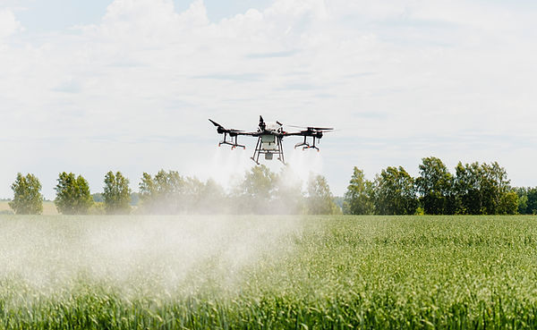
Precision Farming Powered by Advanced Drone Surveying Services UAE
Agriculture in the UAE operates in one of the world’s most challenging climates. Water scarcity, soil variability, and temperature extremes require smarter land management decisions.
Traditional field inspections provide limited visibility. Large farms and forestry zones require data that is measurable, repeatable, and scalable.
This is where Drone Surveying Services UAE and precision Aerial Data Collection UAE transform agricultural operations into data driven systems.
Across Abu Dhabi, Al Ain, Dubai outskirts, and Northern Emirates, aerial intelligence is reshaping how farms monitor crop health and optimize yield.

Case Insight: Improving Yield Through Drone Photogrammetry UAE
A large agricultural operation in Abu Dhabi faced inconsistent crop performance across irrigation zones. Manual field checks were unable to identify early stress indicators.
After deploying advanced UAV mapping:
-
Multispectral imagery revealed crop health variation
-
NDVI analysis identified underperforming zones
-
Geospatial Mapping UAE highlighted irrigation inconsistencies
-
3D Mapping & Modelling UAE supported terrain-based water flow analysis
By integrating drone data into irrigation adjustments, the farm improved yield consistency and reduced water waste.
This demonstrates how Professional Drone Services UAE directly support sustainable agriculture.
Strategic Consultation for Agriculture & Forestry Projects
If your agricultural or forestry project requires:
-
Drone Photogrammetry UAE
-
Precision crop health monitoring
-
GIS Mapping Services UAE integration
-
Land Survey by Drone UAE
-
3D Mapping & Modelling UAE
Our team delivers tailored aerial intelligence built specifically for agricultural environments.